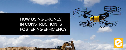
How Using Drones in Construction is Fostering Efficiency
Table of Contents
How Using Drones in Construction is Fostering Efficiency
For any construction company, there are three main aspects that matter – time, quality and cost. Since you can only manage what you can measure, wouldn’t you want to measure every facet of your job site? Of course, you would, but how can you increase the quality of the data you’re receiving from the field? You get an aerial view of it using drones.
With the ability to survey a project in real time and provide quality control, it’s no wonder the growth of drones in construction is one of the fastest ways that construction managers are getting a bird’s eye view of their job sites. Better management of a project can mean increased efficiency and a decrease in costs.
At its most basic level drones in construction can do aerial scanning and surveying which can be the most beneficial at the beginning of a construction project. The ability to do daily scans of the project and collect data.
Video courtesy of Diverse Flight Solutions
Land Surveying
Unlike human surveyors who are constricted to the ground, drones that are equipped with advanced sensors can quickly collect and transmit data faster and with greater precision. When equipped with the right technology, contractors can use the data provided by the drones to build 3-D structural models or help visualize topographical maps that are important for determining the correct amount of materials and reduce excess. The model can also be used as the benchmark and progress can be matched against the original model and plan.
Communication
By using drones in construction, information can be easily passed from the field to the office in real time. The drone can see any issues that arise in real time and send that information back to the office so that a solution can be found quickly. Because of a drone’s ability to survey a site in a short amount of time, the information they collect allows companies to troubleshoot issues (e.g., needed materials) and then efficiently deploy resources to areas of the jobsite. Drones help to minimize potential problems, trim costs and limit delays because of the ongoing data they can provide the project management team.
Keeping Projects on Track
Regardless of the scope of your commercial construction project, a client needs periodic progress reports. With regular drone fly overs, you can efficiently provide an update on any level of detail required. So, how what’s the impact of drone data for the entire project team? Executives gain greater visibility to spot potential problems and mitigate risks that potentially can lead to expensive delays or budget overruns. Project managers collect the information they need to report on progress for projects involving ALL stakeholders. With accurate and up-to-date information, the lead Supervisor can provide subcontractors and other third-parties with crucial information to minimize delays and disputes.
Weekly project meetings are streamlined, and travel to multiple project sites by supervisors is reduced because they can be audited through aerial overviews on mobile devices saving each team member hours in time. Imagine working off a single data set that is plugged into your BIM models.
As mentioned above, for technical teams that want to communicate using BIM models, aerial data can be accurately placed into as-built models, allowing conflicts to be addressed before a expensive problem arises. This overlaid data, available in increments down to the inch, helps prevents potential site conflicts and track exact progress to plan.
Increasing Safety
Drones producing aerial data fosters greater communication around safety as well. All project sites and jobsite workers benefit from aerial video and photography to develop workflows and to create safety and site logistics plans that identify high-risk areas (e.g., high-traffic areas, crane clearances), and hot spots where the material travels to and from the jobsite.
Inspectors and project safety managers can be provided with aerial video or a high-resolution map for safety and compliance training and real-time awareness for the site teams. The jobsite is continually changing, so project teams use detailed images on the changing locations of barricades, riggings, material moves, etc., to prevent potentially hazardous situations. One piece of high-impact visual collateral can tell a thousand words, and save thousands of dollars.
Conclusion
Today, Drones are being used in all of the above ways on jobsites. This activity will only increase in adoption as more time and money is saved on projects. However, drone and aerial data usage in construction is only in its infancy. As Artificial Intelligence and Machine learning technology and other software systems (cloud-based project management, mobile applications, equipment tracking, etc.) innovate, every piece of data collected on the jobsite and recorded in the back office will revolutionize how we build tomorrow. The early adopters will be in the drivers seat in winning more business.